Thursday, June 29, 2017

A voice in the dark - Snoqualmie Tunnel

The Snoqualmie Tunnel is an old railroad tunnel turned into a hiking path. It's part of John Wayne Pioneer Trail, which stretches over 100 miles. Most of it is in Iron Horse State Park.

The tunnel itself is approximately 2 miles long, which lends to a unique, and for me a creepy, hike.

Snoqualmie Tunnel
Washington State Parks and Recreation
Parking permit: Discover Pass ($10 per day/$30 per year)
Distance: 5 miles round-trip
Elevation gain: negligible
Not many hikes have creeped me out as badly as this one. I've hiked Iron Goat Trail (and apparently didn't blog about it [but I'm re-hiking it this summer anyway]), which is widely regarded as one of the state's most haunted trails, and I've hiked to the Sumas Gold Mine, which has a lot of history and relics from the past, but no trail has profoundly scared me as badly as this one.

The trailhead is shortly off I-90 exit 54 for Hyak. From the exit head south toward the tiny little community, and then immediately hang left on NF-906. After a bend in the road, parking for the Iron Horse State Park is on your right.

About half a mile from the trailhead, you'll hit the tunnel.


The tunnel is 2 miles long but fairly straight. From either end, I could see the light on the other end. It felt like an exercise in futility, however, as the light is so far away, it doesn't feel like it's getting any closer until the final quarter-mile or so.

Heading through the first time, I was alone, and it was profoundly creepy. There was only one other car at the trailhead before me. It appeared no one else was in the tunnel. My tiny little light illuminated alcove after alcove of what appeared to be old switch panels of some sort, but I kept thinking about how easy it would be for someone to hide there.

About halfway through the tunnel, I heard a voice behind me. It sounded like a man clearing his throat. I turned around, but could see nothing in the dark, just the few yards my flashlight could illuminate and the now-distant spot of light at the end of the tunnel. I power-walked the hell out of the tunnel as fast as I could. At the picnic area on the far end, I waited to see who would emerge. Coming the other direction down the John Wayne Trail were a pair of guys who had hiked further than I (and I later discovered the other car at the trailhead belonged to them), but no one ever emerged from the tunnel behind me. Where did the voice come from? I can't tell you as I never found out.


A small outhouse and some picnic facilities await you at the other end of the tunnel.
Going back, I was about a hundred yards behind the other hikers. They conversed most of the trip, and even though I didn't know them, it was comforting just to be sharing the tunnel with someone else, someone concrete and physical anyway. As I reached the starting point, a family of five was getting ready to bike through the tunnel.

I can promise I will never hike this tunnel again alone. Bring some company with you on this one. It's the most terrifying hike I've ever done, and I don't care to repeat it.

Thursday, June 22, 2017

Boulder Cave: Please do not disturb the bats - May 2017

This is a short, unique trail that's open seasonally from late May to October. When I checked it out, the US Forest Service still had the trail marked as closed, so I called the Naches Ranger Station at (509) 653-1401 and verified it was open before I left. Endangered Townsend bats call the cave home, so the trail is closed during their active mating season to avoid disturbing the bats. Bring a flashlight if you explore the cave; it's gets dark in there!

The bats are at risk for White Noise Syndrome, which is caused by a fungus that grows around the muzzles of hibernating bats. It is very important that you do not bring in gear that has been used in other caves without thoroughly cleaning it first! This is important to stop the spread of the invasive fungus across the US. There are boot brushes at the caves which you are required to use before entering, but if you do a lot of caving it's best to decontaminate your gear fully before and after going into the cave. Also, it's best to leave four-legged hiking friends at home for this one; while they aren't explicitly banned, they're strongly discouraged.

It may also be a good idea to bring a trash bag. We went 3 days after the trail opened for the season, and already there was a lot of trash along the trail, especially by the caves. It was very disappointing. Remember: pack it in, pack it out!

Boulder Cave
Okanogan-Wenatchee National Forest
Parking Permit: NW Forest Pass ($5 per day/$30 per year)
Distance: 1.4 miles round-trip
Elevation gain: 235'
From Yakima, take Highway 12 west toward Naches. Past Naches at the junction with Hwy 410, go straight and stay on 410 until you get to Cliffdell. Past the little community, look for a sign for Old River Rd and Boulder Cave Recreation Area. Hang a left and go over the bridge, and hang right. Drive past Camp Roganunda to the recreation area at the end. This is a great place for a picnic breakfast or lunch if you brought one.

The trail picks up near the west side of the recreation area. You'll pass a lookout that juts out above the canyon, as well as get views of a young cave that's forming downstream from the main caves.

View of a relatively newer cave.
Eventually you'll reach a junction. Follow the signs for the cave entrance. There are boot brushes at the entrance, and I presume the one-way route also helps with traffic flow during busy summer weekends.


The cave is short, but it gets very dark! Make sure you bring some sort of light source. 


In short order, you'll see the light on the other side.


The trail takes you back up the way you came for a short, sweet hike not too far outside of Yakima.

Thursday, June 15, 2017

Edgar Rock doesn't feel as steep as it is - May 2017

So far, Edgar Rock has been one of my favorites since I moved to the Yakima area. It is not far outside of town. It is 1.1 miles to the summit, which makes it a short hike. You pick up 1470 feet in elevation, but it's a steady climb that makes efficient use of that mile, so it doesn't feel dramatically steep. It's a short little conditioner that I plan to repeat plenty in the future!

Edgar Rock
Okanogan-Wenatchee National Forest
Parking permit: None needed (shoulder parking)
Distance: 2.2 miles round-trip
Elevation gain: 1470'
From Yakima, take Highway 12 west toward Naches. You'll pass through Naches. At the junction with Hwy 410, stay straight to go on 410. After almost 18 miles, not far past Gold Creek Saloon, you'll see a sign for "Lost Creek Village"; follow the sign to turn off on the left. You'll follow the road (Old River Road, though good luck finding a sign to tell you that) until you reach a T junction with a dirt road. Hang a left on the dirt road and follow it until you get to a sharp hairpin turn; you'll see the sign for Trail 964 on the right. The road is narrow but there's parking for 4-5 cars on a couple shoulder pull-outs in the area.


You'll climb up through the pine groves that provide shade from the sun. The landscape here can't figure out if it wants to be forest or steppe, which makes for a unique landscape. About halfway up, there's a lookout area if you need a break. Afterward, you'll alternate between shaded tree cover and walking past craggy rock formations that climb out of the surrounding landscape.


Two boulders and a tree have arranged themselves just so.
 

I didn't get photos, but I did see a couple very curious elk. They stayed a respectable distance away. Scat on the trail indicates there's probably a healthy population in the area.

Near the top, you'll come across a T junction helpfully marked "Trail". You'll want to hang right to go up to the Edgar Rock summit.

At the top, you can find the old foundations of a fire lookout that once sat. It's a good place for a picnic lunch! It was rather windy when I went up. I didn't linger too long before retreating back into the trees for some cover.


Overall, it was a great, short hike that wasn't too terrible far out of town. Definitely one to return to!

Thursday, June 8, 2017

Umtanum Creek Falls

This one was especially fun for me because there was actual tree cover on this hike, something that's been lacking since I moved over to the east side.

From Ellensburg, take I-82 exit 109 and hang north on Canyon Road toward Ellensburg. Take a Left on Umptanum Road and follow for 9 miles. You'll eventually run out of pavement. The well-marked parking area is on the left.

Umtanum Falls Trail
Washington State DNR
Parking Permit: Discover Pass ($10 per day/$30 per year)
Distance: 2 miles (round-trip)
Elevation gain: 235 feet
Take the left trail from the parking lot; the right trail leads you up in the wrong direction. Follow the creek, taking care on a few slick creek crossings.


You'll alternate between forest and meadow. Make sure you bring bug repellent!


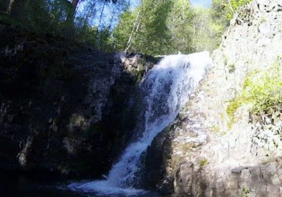
After a mile, the trail abruptly ends atop a large basin as water cascades down.


I had a friend who hiked up the forested side of the hill and went around that way to get across the basin for a good view, but she said it was nerve-wracking. Indeed, I attempted it and backed off. Instead for a view of the falls, I crossed the creek and climbed up toward the chimney-esk basalt formations and descended along a rough trail by a talus field. It was steep and required all four limbs to navigate, but I managed to climb down into the basin.


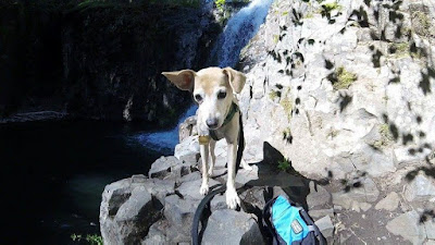
Hiking buddy!


There appeared to be a trail that lead to an area where someone had camped recently (and left their trash, unfortunately). Here I decided to turn around and head back. It's a lovely short jaunt, with cool water and tree cover making it a great warmer-weather hike!