From Ellensburg, take I-82 exit 109 and hang north on Canyon Road toward Ellensburg. Take a Left on Umptanum Road and follow for 9 miles. You'll eventually run out of pavement. The well-marked parking area is on the left.
 |
| Umtanum Falls Trail Washington State DNR Parking Permit: Discover Pass ($10 per day/$30 per year) Distance: 2 miles (round-trip) Elevation gain: 235 feet |
You'll alternate between forest and meadow. Make sure you bring bug repellent!
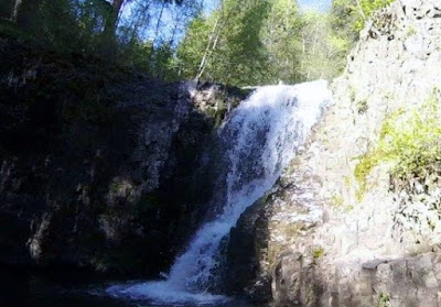
After a mile, the trail abruptly ends atop a large basin as water cascades down.
I had a friend who hiked up the forested side of the hill and went around that way to get across the basin for a good view, but she said it was nerve-wracking. Indeed, I attempted it and backed off. Instead for a view of the falls, I crossed the creek and climbed up toward the chimney-esk basalt formations and descended along a rough trail by a talus field. It was steep and required all four limbs to navigate, but I managed to climb down into the basin.
 |
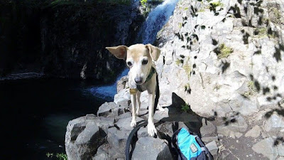
| Hiking buddy! |
There appeared to be a trail that lead to an area where someone had camped recently (and left their trash, unfortunately). Here I decided to turn around and head back. It's a lovely short jaunt, with cool water and tree cover making it a great warmer-weather hike!


No comments:
Post a Comment