My internship in Anacortes is sadly nearing a close. There will only be one more internship special after this! At least for Anacortes; I still have three more internships to go, and who knows where they'll be?
I found this hike listed as "Sares Head" through Washington Trails Association. However, no one in Anacortes knows "Sares Head". They do know "Sharpe Park", though, which takes you to the Sares Head viewpoint. So if you're asking for directions, ask for "Sharpe Park" and someone will tell you how to get there.
The park is not far from Deception Pass State Park. From Highway 20, you can head East on Rosario Road just before Deception Pass and follow it until you get to the trailhead. The little gravel turnout is "Parkview Road", and there's a nice big sign out front to let you know you've arrived.
 |
| Signage |
Note on the official map that north is to the right. That just bugs me, when north isn't up...
 |
Sharpe Park/Montgomery-Duban Headlands
Parking Permit: none needed
Distance: 2.2 mile loop
Elevation: 400' difference
|
There are lots of shortcuts. I decided to make a loop around the perimeter of the park. Including the jaunt out to Sares Head, it would be 2.2 miles.
There's a plaque and some signage at the trailhead....
 |
| More signage! |
I had packed hiking boots, but had neglected to pack a change of pants. So I set out in dress slacks for this hike!
 |
| Impeccable fashion sense! |
You start out passing some nice wetlands. There were lots of birds. There's a trail that goes off to a "wetland view", but it was somewhat overgrown and I still had delusions of sparing my dress slacks at that point, so I stuck to the main trail. It still had decent marsh views.
 |
| Marsh! |
 |
| More marsh! |
Pretty soon, you reach the first major junction and are faced with a
choice:
 |
| The Choice |
I knew I wanted to make it out to Sare's Head, but "Rocky Bluffs" was tempting, so I went right and began a large counter-clockwise loop around the park.
Not long after, I had another choice for "Upper Loop" or "Lower Loop". I took the upper loop, because why the hell not?
Quickly, the nice level gravel path turns into something a bit more rugged...
 |
| Rugged trail |
It's not a large park, but it makes up for its lack of size with some rather ankle-twisty trails with plenty of rocks and tree roots jutting out.
I liked how the trees were curving over the trail in this shot:
 |
| Framed in green! |
There are also a
lot of madrona trees in the park, of which I took great pleasure in photographing.
 |
| Madrona! |
 |
| More Madrona! |
The "Upper Trail" takes you up a big rock, but there's not much to see. I didn't even take a pic from the top. It's just a big hill to give you some extra elevation gain for you hike.
 |
| I did take a picture from the bottom of the rock, though. |
I wondered...was this sign bluffing? Hmm?
 |
| Thank you, I'll be here all night. |
As I descended down the trail, I started noticing odd light-colored spots on the hill.
 |
| Nope |
I took a closer look and....
 |
| Nope |
The hillside was
covered in spiderwebs. The entire hill. The sign
was bluffing!
 |
| Nope nope nope nope nope. |
I had recently met a gentleman who had gotten bitten by a brown recluse on this very island, while he was sleeping in bed, so I was not feeling very amicable toward spiders.
I also found this ominous piece of graffiti on a tree.
 |
| Good advice on a spiderweb-coated hill. |
Oh look, more madrona trees! Yes, trees, lalala....
 |
| Madrona! |
 |
| Madrona grove! |
Is that water down there? Are we almost out of the spider-infested woods?
 |
| Madroooooona.... |
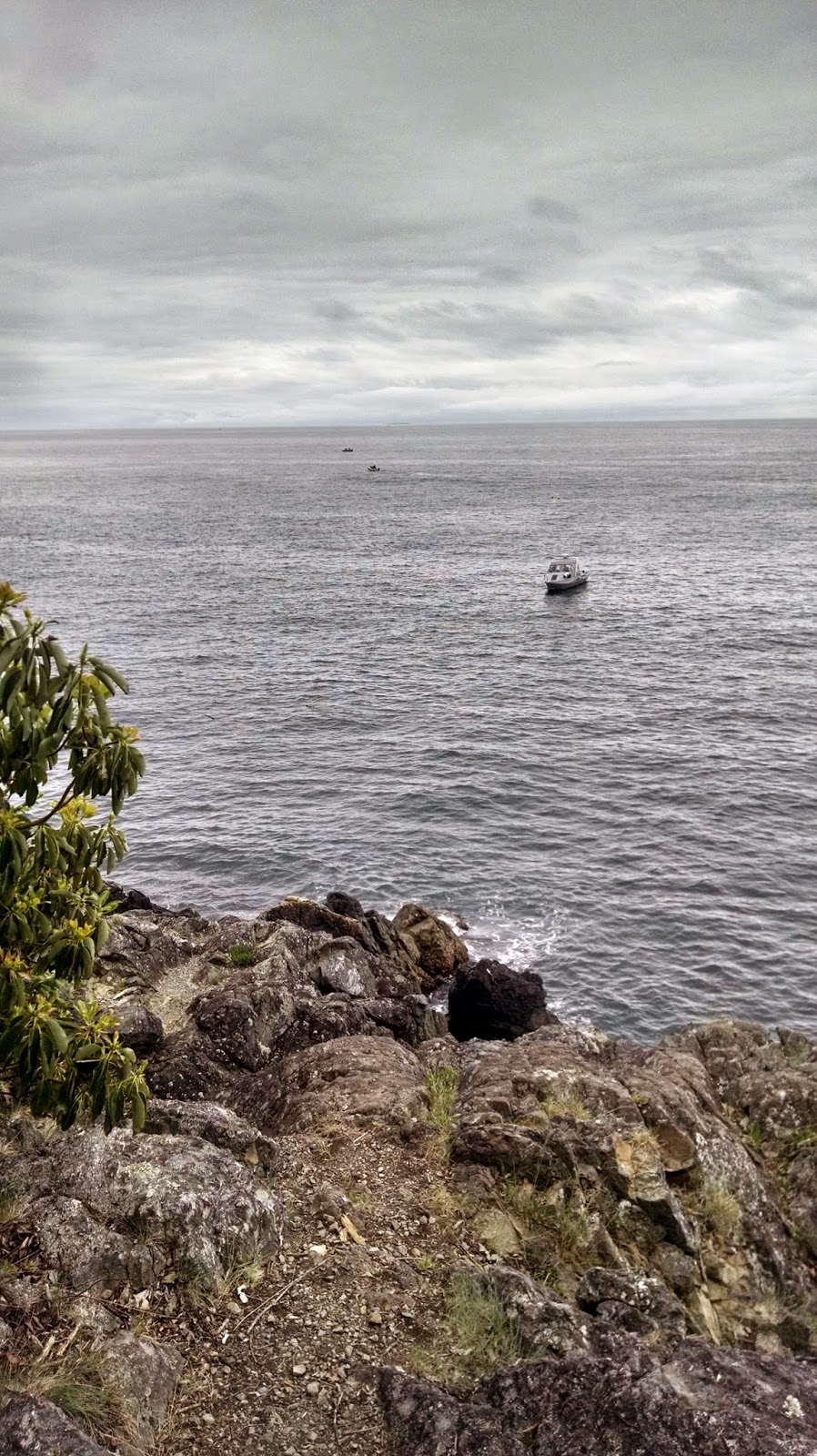
Phew, finally the woods opened up and I made it to the Montgomery-Duban bluffs.
 |
| Bluffs! |
 |
| More bluffs! |
There are lots of sharp rocks at the bottom, so don't fall!
 |
| I can't actually advocate that you stand this close to the edge. |
Despite the gray skies, plenty of boaters were out doing their boater things.
 |
| They're on a boat! |
I tried to capture all the bluffs on both sides of me, first by taking a pic out toward the water...
 |
| Water! |
Then I turned around and took a pic of the land...
 |
| Rocks! |
Then I gave up and took individual pics of each side for you:
 |
| More rocks! |
 |
| Even more rocks! |
I found some shrubs that I don't think I've ever come across before. I haven't been able to identify it. Anyone know what it is?
 |
| Red and green leaves |
As the trail bends away from the shore, it's sufficiently steep and rocky.
 |
| Steep stuff! |
We follow the trail, and....
|
| ....bluffing? |
Wait a minute...
 |
| Intended route... |
Hold on....check the map again....
 |
| Oh, shit. |
Somehow I ended up taking the Starbucks Connector back to Bluff Trail. I made a loop, but it was not the loop I intended!
Apparently, when you want to head south along the Starbucks Connector to head out toward Sares Head, it's not obvious. Here is the junction, with the path I needed to take breaking off to the right:
 |
| It's hiding in plain view. |
I had to step up on a rock to get that pic. From the trail down on the left, you barely notice it! So fair warning, it's almost immediately after the steep stuff that you need to find this junction. A simple trail marker would go a long way here!
Back on the trail, I found where the Bluff Shortcut meets up with the Starbucks Connector.
 |
| And there's a bench, too. |
More madronas!
 |
| Madronas! |
This boardwalk has seen better days.
 |
| It's about function, not form! |
Madronas!
 |
| Yay! |
The trail out to Sares Head is well-traveled and better maintained than other trails in the park. There's been some recent trail clearing and leveling work through here that still appears to be ongoing.
 |
| Seems legit. |
One final climb, and when you get to Sares Head, it's absolutely
fantastic.
 |
| View! |
 |
| So much view! |
 |
| VIEW! |
Sares Head is a big, moss-covered rock. There's a well-graffitied bench to sit at, though I think I'd just bring a blanket and spread out on the rock itself.
 |
| Rock! |
To the north you can see Anacortes and to the south, a bit of Oak Harbor is visible. The tiny speck in the clouds about 1/3 in from the right was a jet on a landing approach at the naval air base; they were doing training and had been noisily flying over Anacortes all day.
You can't
quite see Deception Pass, but it would be just up that channel to the left.
 |
| More view! |
This park is small, but it would be very easy to combine it with some hiking in Deception Pass State Park. It would make a great add-on to the Deception Pass Headlands on the Fidalgo side of the park since it's literally just up the road, so I think I will return again. It was fantastic on a cloudy day, so I expect that it's truly spectacular when it's sunny and clear!
Next week: Part 5, the final part of the Anacortes Internship Special: Return to Guemes Channel!