Showing posts with label boats. Show all posts

Thursday, October 22, 2015

Trees and more trees - Hoypus Forest

Long time no post! Due to schedules, weather, and personal life, I have not had much time to hike, let alone post. I finally, finally got a hike in on Sunday, though! I decided to head to Deception Pass to check out a corner of Deception Pass State Park that I'd never visited before.

To get to Hoypus Point Natural Forest Area, turn onto Cornet Bay Road from Hwy 20 (on the Whidbey Island side of the pass) and follow it all the way until the end.

Hoypus Forest Natural Forest Area - Deception Pass State Park
Parking Permit: Discover Pass ($10/day or $30/year)
Distance: 5 miles
Elevation gain: 400'
The parking is right alongside busy docks and a boat ramp. Signs advertise that you can park here for boat tours. I imagine it fills up in the summer, but on this gray and drizzly autumn day it was fairly quiet.


To start off, you'll walk down the road past the gate for about a mile. It's a level and easy hike, with lots of beach access along the way. I encountered a family that had biked down to their favorite beach spot. It seems to be a popular path with the locals.

None shall pass. Except hikers. Hikers are okay.

Along this stretch, you'll get peek-a-boo views of Deception Pass Bridge through the foliage.


At the end of the road is a clearing. A small service road goes up to a storage area, and two trails branch off the end. To get to Hoypus Point, take the left one that hugs the water.


Hoypus Point is a small clearing that opens up to beach. You can see Fidalgo Island to the north. It was pretty misty when I went.


The beach is small but sandy, something uncommon in this region of rocky beaches. It would make a great lunch spot!


Back to the end of the road, take the other trail, which is the East Hoypus Point Trail. Heading into the woods, the trails are fortunately a little more well marked.


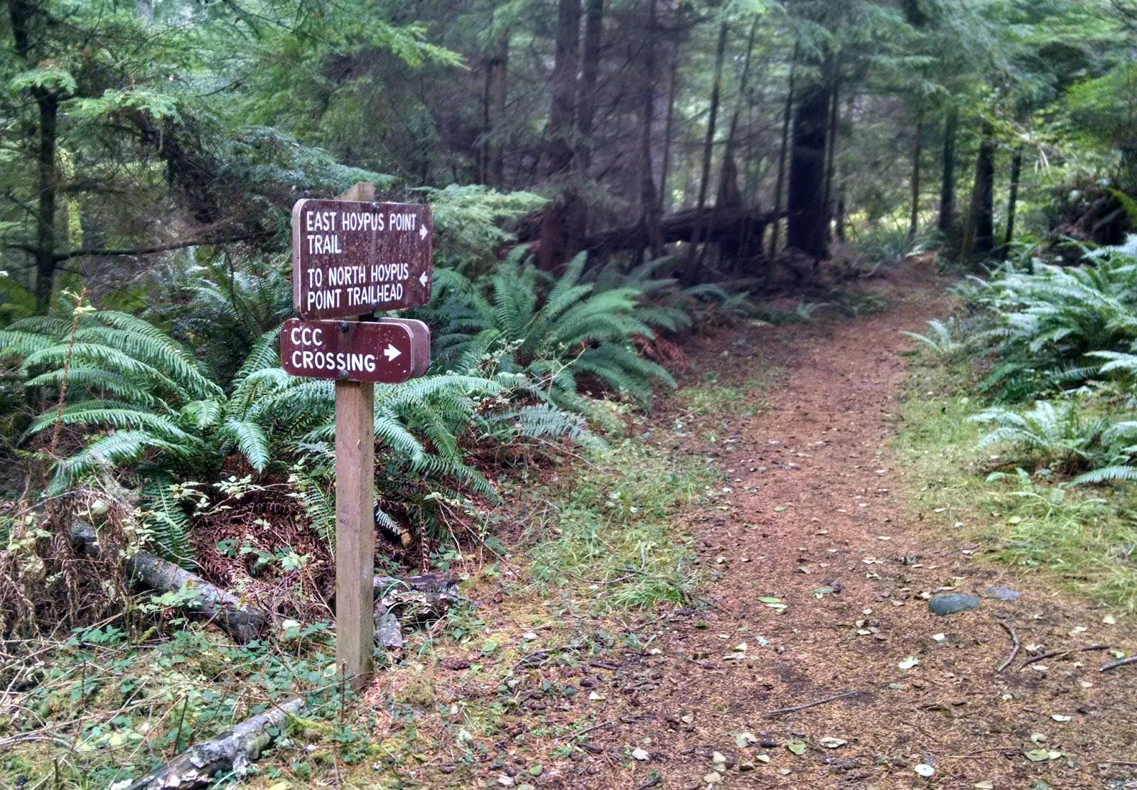
There is a decently sized trail system here, so you can mix and match trails to shorten or lengthen your hike as you wish. I plotted out a loop that was five miles including the jaunt out to the point.

There are some amazing trees in here.


This dead tree had a little bit of new growth coming out the top.

Seems like as good as any a spot to take up root.
I was especially fascinated by the fallen giants.

The dog is small, but he looks even smaller here.


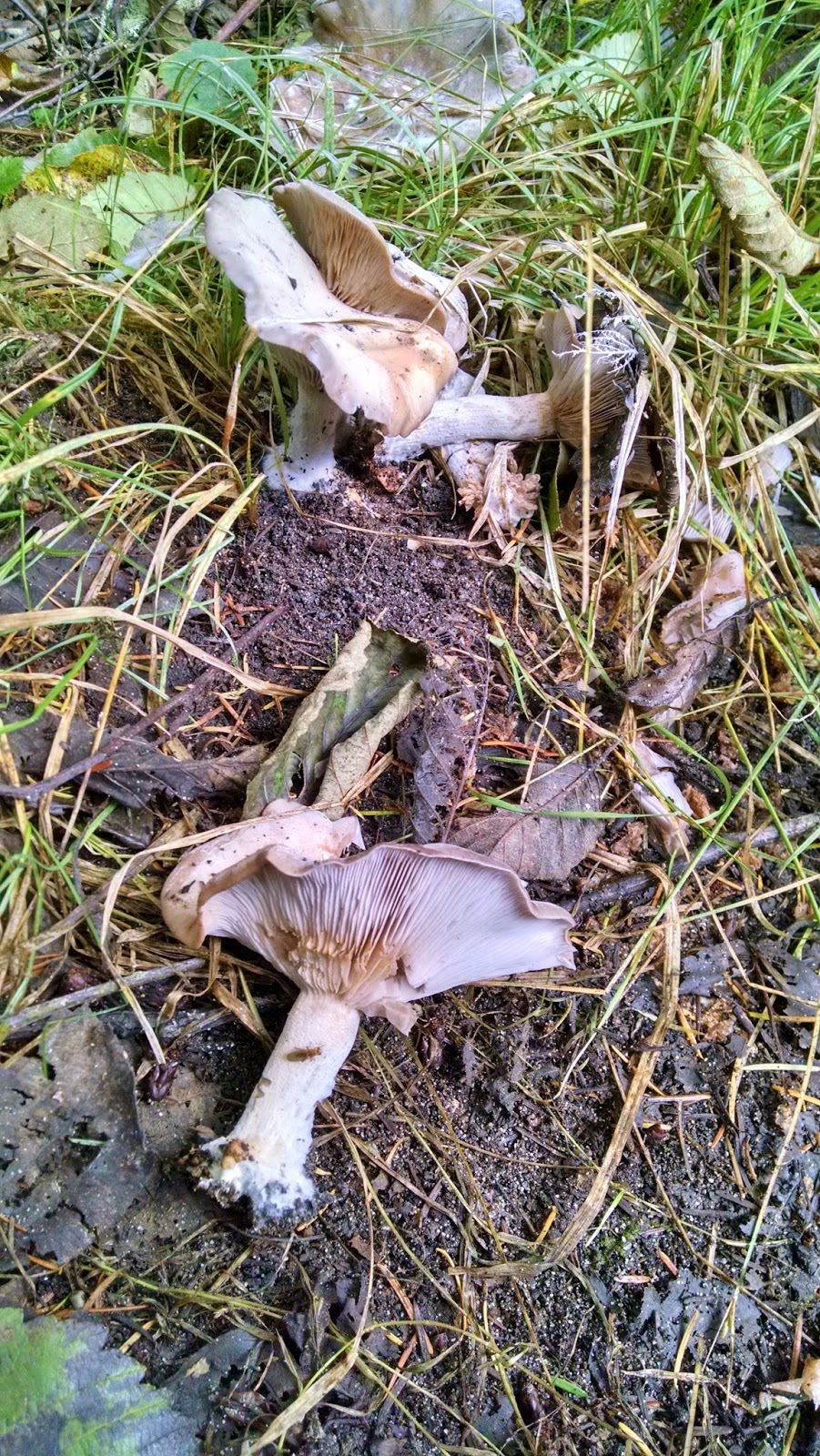
There were also lots of mushrooms. I thought these were particularly pretty. I am not a mushroom person though, so not sure what kind they are.


You'll run into the boundary of the park eventually, as well as some residents' backyards, so be respectful. There is a junction with Fireline Trail that will take you back toward the parking lot, but I pressed on for a bit of a longer loop. There are a few unmarked junctions, so when in doubt, hang right. After a brief climb, I turned on the aptly named Hemlock Hideaway.


Then I turned on Forest Grove.


I didn't notice there was a trail named "Slug Slough" when I was initially planning my route, so didn't take this trail, but I wondered if it was as aptly named as the others.


Even though the forest is surrounded by civilization, when you're in the thick of it it's dead quiet and seems to stretch forever.


I rejoined Fireline Trail and then followed the signs back to South Hoypus Point Trailhead to finish off my hike.

The first route I planned out was over 7 miles long when I plotted it out, and you can make even longer routes, so you can spend a fair amount of time exploring these woods. It was a great relaxing getaway for a few hours on Whidbey Island.


I'm not sure how often I'll be able to update here as we go into the winter months. I will see if I can pull photos from old hikes and run with those. I may cut back to updating every other week though. We will see what happens.

Thursday, July 16, 2015

Sail Away - Zuanich Point Park to Tom Glenn Commons

Alright, so I am not seeing much in the way of free time for the next few weeks, so you'll see a lot of these short little "urban hikes" as I half-ass my way through the next month. Sorry.

Anyway, today I headed down to Zuanich Point Park by Squalicum Harbor. It's a small park, but there's a good path around the harbor to make a 2.5 mile round-trip walk.

Zuanich Point Park to Tom Glenn Commons
City of Bellingham
Parking permit: None needed
Distance: 2.5 miles roundtrip
Elevation gain: none
Start by parking at Squalicum Boathouse. Take Coho Way into the harbor area all the way back, then hang right.

Squalicum Boathouse is the name for a reception venue in the park.

Not, like, a real boat house
 To start this walk, head toward the water to the fisherman's monument, which is close to the parking area.


From here, join the paved path and head south to the end of the point. This is a great park for a picnic and for kite flying. Despite it being breezy out, though, there were no kite fliers today.

The end of the point gives you good views of Western Washington University, South Hill neighborhood, and Fairhaven in the distance.

Also, a good view of a "Danger" sign
For the record, they shoot off fireworks for 4th of July across from here, so getting a seat as close as you're allowed to that sign is the best viewing option.

The end of the point is also where the yacht club has its junior sailing club. They were getting set up as I went by,

Mini sailboats
 Now you just walk around the harbor! I snapped a pic of a catamaran I saw, since the husband is fond of those.


The path has lots of benches and picnic areas. It also has fitness equipment, because why not?

Break from walking exercise to do other exercise!
 This section of the harbor is mostly recreational boats, while the section to the north is more industrial fishing boats. Sometimes you see them side-by-side, though.

Work and play
During the right season, you can come down to this part of the docks and buy fish directly off the boats! Today wasn't the right season, apparently.

Eventually you'll join up with the sidewalk on Roeder Avenue briefly. Keep to the wider portion of the sidewalk on the harbor side, and you'll be lead back away from the street near the Lake Union Sea Ray shop.

Eventually, you seem to run into a dead-end at the Harbor Center...

Dead end?
 ...but just get up on that sidewalk, hang left, and take the boardwalk all the way through the center.

Not a dead end!
You'll see where to pick up the path again on the other side.


One thing I love about this path are all the flowers. The entire harbor is lined with color!


Hotel Bellwether sits at the end of the harbor.


You can look across the water and see where you came from.


By this point, the junior sailing club seemed to be having a learning experience on how to right a tipped boat...


As soon as they got it back up, it tipped again. And again. It was breezy out and they were struggling. But it sounded like they were still having fun.

The three-story lighthouse at the Bellwether is actually all one suite.


During peak season, it will run you over $1000 to rent for the night. But hey, jacuzzi tub!

The Tom Glenn Commons aren't much to look at. They're just a nice place to sit and take in views of downtown.


Or views of buildings.


And that's it! You just walk around the harbor! To get back, just go back the way you came, or keep going along the path and take a short loop around the buildings near the Bellwether (you'll run out of paved path and have to trek across a gravel lot to get back toward Squalicum Harbor).

I spotted another catamaran on my way back...


And waaay out in the middle of the harbor was a trimaran.


This was just my short walk, but you can connect to other trail systems. Roeder Ave is currently under construction to the south, but normally you could take it all the way to connect with the South Bay Trail which leads to Fairhaven. Head north on Roeder, and you run into the Squalicum Creek trail system.