Thursday, July 23, 2015

A Lazy "Hike" - Whatcom Falls Park

What can I say? I'm swamped! Hopefully I'll have something more substantial next week. Until then, it's another urban "hike" in Whatcom Falls Park.

Whatcom Falls Park has a lot of trail, and you can mix and match paths to create dozens of different routes. This one is a bit over a mile and a half and takes you down a quiet corner of the park that I wanted to share.

Whatcom Falls Park
Bellingham Parks & Rec
Parking Permit: none needed
Distance: 1.65 mi
Elevation gain: minimal
I parked in the lower lot down Silver Beach Road. You can start by hiking to the stone bridge by the falls; just follow the sound of the water.

Unfortunately, recent drought conditions have left the falls a bit less than impressive...

Behold!
 I think this was the lowest I've ever seen the falls flow!

Continue on the main trail to the right. There are a few smaller falls that right now are just trickles of water. Lots of kids were swimming by them. A year or two ago, a guy drowned when he went over one of the small falls and the current pulled him and pinned him under. They always stress that swimming is dangerous in the creek. Right now there isn't much current to worry about though, just low water levels.

A set of stairs provide the only elevation you have to worry about.


At the top you'll hang a right on Whatcom Creek Trail. If you're here in the morning, keep an eye on the canopy, especially the knotty-looking fir at the next trail junction. There's a resident pair of owls that like to observe walkers around here.

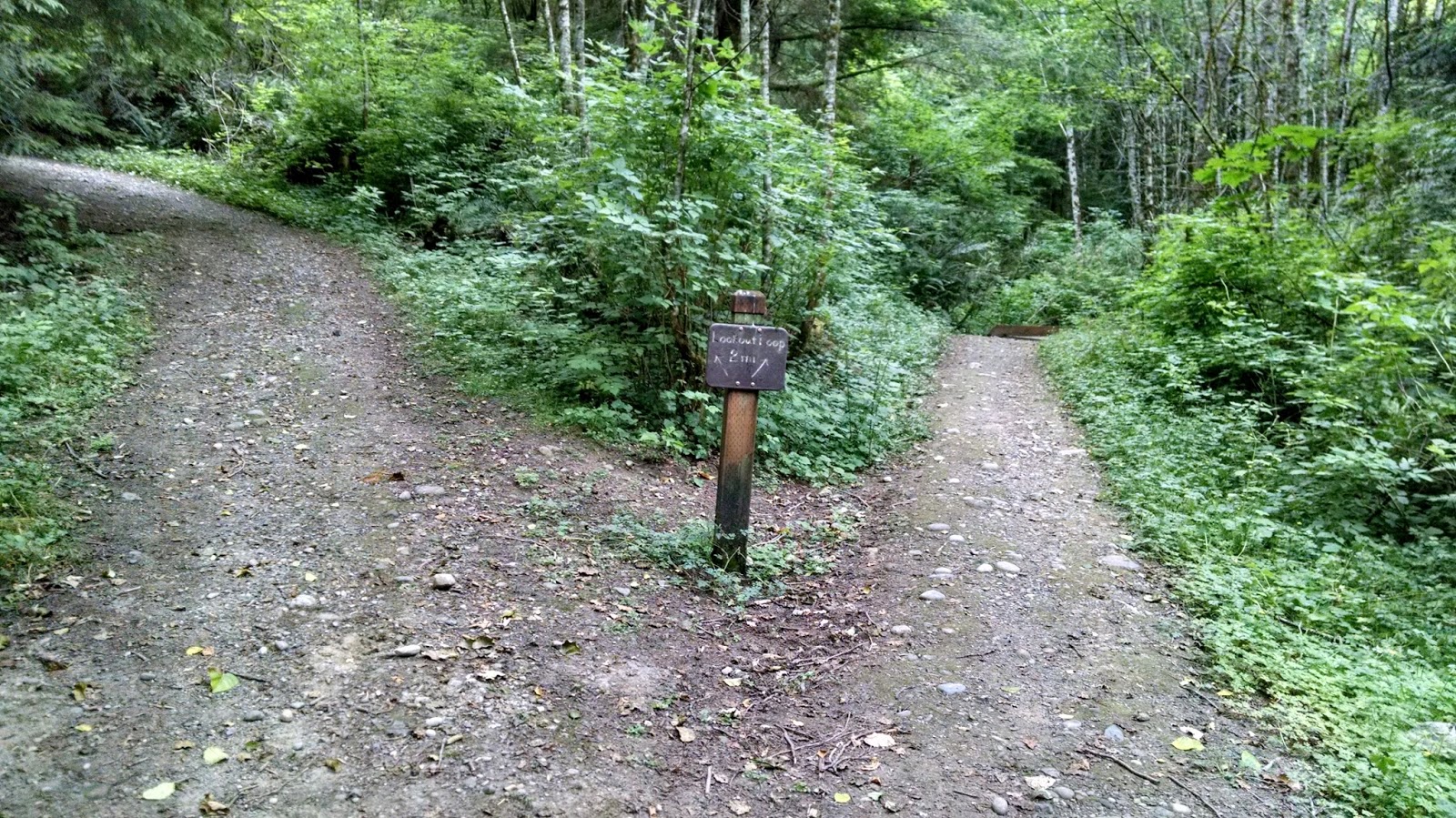
Eventually you'll reach a funky 5-way junction. The shallow-right that's blocked off with a large rock leads to a somewhat interesting overlook, and the leftmost path is the continuation of the main trail.


Here's the overlook. The rock blocking the path is to prevent wayward cyclists from speeding too quickly this way, as it comes to an abrupt end.


Back in the day, there was a mill at what is now Bloedel Donovan Park. Timber was harvested from the hills around the lake, floated to the mill, processed, and then taken by rail to the waterfront via these tracks.

Eventually you'll reach a big junction. Left takes you on Railroad Trail which follows the aforementioned tracks. You can take it to Alabama Hill, down to Barkley Village, and through town all the way out to Memorial Park if you are ambitious enough. Most people walking will turn right to start looping back toward the parking lot. I go straight and follow the sign to Scudder Pond though for a quieter, less-traveled loop.

Pup sniffing the trail marker and considering making his own trail marker.
Head down until you see an unsigned-but-official looking trail to the right. If you can see the pond, you passed it (though you're still on a nice walk).


The trail will narrow and close in a bit, but there are few people that wander this way.

The baseboards of this little lookout are often underwater. It has been dry lately. The lake is at levels normally not seen until September; the heat has been evaporating the water that quickly.


There's a house on the pond with a stone chimney-looking thing; it's actually a bell tower and I want a house with a bell tower so bad -- this is an actual thing this house has!

White house has a bell tower!
 There are a lot of blackberries in the park, but it's so busy they're usually picked clean. The Scudder Pond Loop often has plenty, though!


You only actually get small glimpses of the pond. Most of the brush is packed in around you. It gives you shade and quiet, though.


You can also get a close look at the dam that maintains Lake Whatcom's water level and the flow through Whatcom Creek.


Back at the main trail, take a left on Railroad Trail and go across the bridge to take you back across the creek.


You can get another view of the dam, too.


Left takes you to Bloedel Donovan Park. There isn't much for trails there; it has a playground, swimming area, and boat launch. I go right instead to go back to the parking lot.

You'll past the other end of the train trestle.


The creek will slow and widen and become Derby Pond. It's a nice place to fish for kids. It's also good for feeding the ducks, though it was so hot out that only a couple were out.


The trail merges with a paved road. Going left will take you uphill to the upper parking lot off Electric Ave, which is an alternative starting point. Right leads you back to the lower lot.

There are some private residences here inside the park; I am not sure how they get their vehicles in and out since the road is blocked with locked barriers to non-park vehicles. Conceivably though, you could live here. I'm not sure why you'd want to, but you could.

There's also a fish hatchery that raises varieties of trout and other freshwater fish just off the parking lot.

I don't know what happened to this tank, but there were a lot of dead fish floating around in there....

They were just practicing their backstroke?
Fortunately the other tanks that had fish in them seemed to be in better shape.


And that's it. I'm busy with internships. I'll get around to a real hike sometime. But until my schedule opens up, this is what you get to deal with.

Thursday, July 16, 2015

Sail Away - Zuanich Point Park to Tom Glenn Commons

Alright, so I am not seeing much in the way of free time for the next few weeks, so you'll see a lot of these short little "urban hikes" as I half-ass my way through the next month. Sorry.

Anyway, today I headed down to Zuanich Point Park by Squalicum Harbor. It's a small park, but there's a good path around the harbor to make a 2.5 mile round-trip walk.

Zuanich Point Park to Tom Glenn Commons
City of Bellingham
Parking permit: None needed
Distance: 2.5 miles roundtrip
Elevation gain: none
Start by parking at Squalicum Boathouse. Take Coho Way into the harbor area all the way back, then hang right.

Squalicum Boathouse is the name for a reception venue in the park.

Not, like, a real boat house
 To start this walk, head toward the water to the fisherman's monument, which is close to the parking area.


From here, join the paved path and head south to the end of the point. This is a great park for a picnic and for kite flying. Despite it being breezy out, though, there were no kite fliers today.

The end of the point gives you good views of Western Washington University, South Hill neighborhood, and Fairhaven in the distance.

Also, a good view of a "Danger" sign
For the record, they shoot off fireworks for 4th of July across from here, so getting a seat as close as you're allowed to that sign is the best viewing option.

The end of the point is also where the yacht club has its junior sailing club. They were getting set up as I went by,

Mini sailboats
 Now you just walk around the harbor! I snapped a pic of a catamaran I saw, since the husband is fond of those.


The path has lots of benches and picnic areas. It also has fitness equipment, because why not?

Break from walking exercise to do other exercise!
 This section of the harbor is mostly recreational boats, while the section to the north is more industrial fishing boats. Sometimes you see them side-by-side, though.

Work and play
During the right season, you can come down to this part of the docks and buy fish directly off the boats! Today wasn't the right season, apparently.

Eventually you'll join up with the sidewalk on Roeder Avenue briefly. Keep to the wider portion of the sidewalk on the harbor side, and you'll be lead back away from the street near the Lake Union Sea Ray shop.

Eventually, you seem to run into a dead-end at the Harbor Center...

Dead end?
 ...but just get up on that sidewalk, hang left, and take the boardwalk all the way through the center.

Not a dead end!
You'll see where to pick up the path again on the other side.


One thing I love about this path are all the flowers. The entire harbor is lined with color!


Hotel Bellwether sits at the end of the harbor.


You can look across the water and see where you came from.


By this point, the junior sailing club seemed to be having a learning experience on how to right a tipped boat...


As soon as they got it back up, it tipped again. And again. It was breezy out and they were struggling. But it sounded like they were still having fun.

The three-story lighthouse at the Bellwether is actually all one suite.


During peak season, it will run you over $1000 to rent for the night. But hey, jacuzzi tub!

The Tom Glenn Commons aren't much to look at. They're just a nice place to sit and take in views of downtown.


Or views of buildings.


And that's it! You just walk around the harbor! To get back, just go back the way you came, or keep going along the path and take a short loop around the buildings near the Bellwether (you'll run out of paved path and have to trek across a gravel lot to get back toward Squalicum Harbor).

I spotted another catamaran on my way back...


And waaay out in the middle of the harbor was a trimaran.


This was just my short walk, but you can connect to other trail systems. Roeder Ave is currently under construction to the south, but normally you could take it all the way to connect with the South Bay Trail which leads to Fairhaven. Head north on Roeder, and you run into the Squalicum Creek trail system.

Thursday, July 9, 2015

Help my dog raise money for Washington trails!

This is my dog, Ozzy:

Hi, Ozzy!
He loves hiking. Loves it! He loves sniffing the flowers and peeing on rocks.

Trail dog!

This summer, Ozzy is going to use his hiking prowess to give back to Washington trails, and you can help him!

Who wouldn't want to help such a cutie?
Ozzy has signed up for this year's Washington Trail Association's Hike-a-Thon. Ozzy is going to hike as much as he can in August to raise funds for the association, and you can help! You can pledge donations by the hike or by the mile.

Hiking!
The Washington Trails Association is crucial to the maintenance of our trail systems. If you've ever hiked an overgrown or eroded trail and wondered why doesn't someone fix this?, well the WTA are the magical trail fairies that make it happen!

WTA also provides advocacy for trail funding, forest service road maintenance, and conservation efforts. From WTA's website, you can find trip reports from other hikers so you can read about trail conditions before you head out.

So if you enjoy hiking in our state, consider supporting my pup and donating to the WTA. Let's keep our amazing trail network running!

You'll make Ozzy happy, too!

Thursday, July 2, 2015

Revisiting Old Haunts - Lookout Mountain Preserve

I grew up (primarily) in Sudden Valley. It's all hills and trees out there; there's not too much to do. So we went out and played in the woods. There are a lot of old logging roads out there, so old they're long buried and are just gaps in the undergrowth where no trees grow. Many of these wind around Lookout Mountain.

It was on this mountain that I would pack a snack and hike on it late into the afternoon, exploring the old roads until the paths faded into the forest. It was also where I learned to appreciate how easy it is to get turned around in the woods. There's nothing like following a path that fades into a dead-end, turning around, and realizing you have absolutely no idea which direction you came from! I eventually found my way back, but there were several anxiety-producing minutes where I found myself utterly lost!

A short time after I moved out and away on my own, a chunk of that hill was turned into Lookout Mountain Preserve, and the old trails were made new by being cleared, graveled, and mapped into an official park. The trails are well-maintained, so it's a lot harder to get lost than it used to be!

They keep making progress, too. The preserve is a small part of a much larger reconveyance by the county to buy up and preserve the land around Lake Whatcom. The lake supplies the drinking water for Bellingham and its health has steadily been in decline for a while now, so preserving the land in the surrounding watershed is an important step in improving the condition of the lake. Recently they obtained land stretching all over Lookout Mountain, as well as a great deal of land on the other side of the lake, so expect a massive expansion in the trail network in coming years!

I could not find a decent map online of the trail system, but there's a decent map at the trailhead, so I doodled on that for you!

Lookout Mountain Preserve
Whatcom County Parks & Rec
Distance: 4.7 miles
Elevation Gain: 850'
That map up there on the left shows the most recent land acquisition on the hill. We potentially could see trails linking this preserve with Squires Lake Park on the other side! Wouldn't that be exciting?

To get to this park from Bellingham, you'll want to take Lakeway Drive (I5 exit 253) east out of town. It will turn into Cable St. Take a right on Austin St; it will turn into Lake Louise Drive. Follow it out about two and a half miles; the trailhead is across the street from Gate 9.

Progress on this trail system was evident from the moment I pulled up. A few years ago, there was just limited street parking for a handful of cars. Now, there's a parking lot suitable for 2 dozen vehicles, as well as a privy.

Gotta have privies!

Throughout the entire park, there was also evidence of recent work. Looks like they're working on drainage:

Fresh trail!
I started on the Lower Lookout Loop, which leaves directly from the parking lot and works its way up to the main loop trail. It's been super dry lately, and I didn't hit any mud at any point during the trail. Nearby swampy areas did make mosquitoes a minor annoyance, however.

Moss!

Moss and dead trees!
 When I checked the forecast the day before, it said it would be 85 and sunny. It was more in the 70's, muggy, and passing overhead showers rained down on the forest canopy. Very few drops made it though the trees while I was on the trail, though.

Forest canopy is nature's umbrella
There's just something about hiking through the forest and hearing the rain hitting the leaves overhead but being sheltered by the trees....


Eventually you'll join up with the service road. You can head down to get back to the parking, up for the hell of it, or you can cross and continue toward the main loop trail.


You'll immediately hit a junction on the trail. Left leads to a waterfall, and right leads to the loop. It's worth it to head left. It's a steep, switchbacked climb, but it's a short jaunt to the falls.


When this trail first opened I was thrilled because in all the time I spent hiking these hills before, I never knew these falls existed! Unfortunately, recent drought conditions have reduced them to a trickle.

Hiking buddy!
Come by in a wetter season, and I promise they're more impressive.

Trickly
The map showed some sort of photo op further up. I'd never gone past the falls, so I continued on until I found the spur that led off to the right.

What looks like a single spur on the map actually branches in two. The right branch dead ends at a creek.

The left branch leads to a decent-looking campsite...


...and then dead-ends in a creek. So, probably not worth the extra mileage.

Back down at the main trail, you reach another junction for the loop. It's a loop, so it doesn't really matter which way you go.


I went left to make a clockwise loop, following the old trail I used to take as a kid.

There's another waterfall; again, it's more impressive when it's wetter.

Trickle...
Because this section of trail is following old roads, it's nice and wide, though it does get steep in some parts. My hiking buddy kept running away from me. Can you see him all the way down the trail?

Disclaimer: technically this is not an off-leash area, but you'll be hard-pressed to find anyone out here who cares.
He's actually a pretty good hiking buddy on the steeper stuff. He won't let me take a break! And he doesn't come when I call him; he just stands about 40 feet up the trail from me and stares at me expectantly until I start moving. Then he runs off again.

He's a disobedient dog, which is largely my fault. But he's a good hiking buddy.

After a decent climb you'll reach another junction. Right lets you continue on the loop. Left goes up to a mediocre lookout.


I climbed up to the lookout so you could see. It's what a realtor would call a "peek-a-boo view".

Peek-a-boo!
There is a bench, so it's a nice place to stop for a snack. I munched on a granola bar. I packed a book along with the idea of taking an extended rest break to read, but threatening rain and bugs made me move on fairly quick.

As you continue on the loop, the old road fades away into a narrower trail, but it is still solid tread you can't lose.


Lots of switchbacks wind down fairly quickly until you meet a long, low, flat area that finishes the loop.


You can take the Lower Lookout Loop back down; dark clouds overhead made me take the road as a shortcut back down to the parking lot.

It's nice to see this trail out here for local residents to enjoy. Sudden Valley historically has not managed their recreation fee funds very well, and most of the parks out there have fallen into a sorry state of disrepair. Having a well-maintained county park in this area is a valuable asset to the neighborhood. It's great to come out here and see the rough, unofficial trails I grew up with turned into something like this!