Thursday, July 5, 2018

Endless Switchbacks - Beacon Rock

Do you like switchbacks? This trail has 52 of them, according to the Washington State Parks. I only counted 51 on the way down, but what do I know?

I discovered this hike when I was driving back from Portland along I-84. I looked across the river and saw a lonely, rocky spire. I had to check it out!


Beacon Rock State Park is along the Columbia River gorge, just west of Bonneville Dam. It's a gorgeous area even though across the river is currently scarred from last year's Eagle Creek fire. This hike is short, just a mile to the top, but there's lots of other hikes in the park to choose from to extend your stay.

Beacon Rock
Washington State Parks
Parking permit: Discover pass ($10/day or $30/year)
Distance: 2 miles round-trip
Elevation gain: 600'

Parking is in the state park in a turn-off right off Highway 14. There's a decent privy at the trailhead. Follow the signs to the hiking trail; the other trails you see lead to the technical climbing route.

(Fair warning: if you access it from I-84, the Bridge of the Gods is a $2 toll each way. I did not know this until I got there. They accept plastic, but on my return trip their computer was down so I had to pay with a $20 bill and got all my change in $1s.)

As you climb, you'll zig-zag back and forth along the literally dozens of switchbacks, with amazing views the whole way. There's a commemorative stamp at the summit; I brought nothing to stamp so I used my arm but if you want a souvenir bring a notebook or something. There are a lot of switchbacks. And I mean a lot of switchbacks. It's enough to make you a little...crazy.

In fact, instead of my usual blog writing, I'm just going to give you screenshots of my Facebook feed and let them speak for themselves. Enjoy.


Honestly, this was a really easy hike. Despite the climb, the trail is fairly even. Kids could do this hike. Combine it with other hikes in the park and make a full day trip out of it!

Thursday, June 28, 2018

Hidden Crossings - Umtanum Creek Canyon

This hike has been particularly frustrating for me. It was one of the first hikes I attempted after moving to the Yakima area. My first attempt was in early spring and it was flooded out. My second attempt came a few months later, where about a mile in I found myself stuck, unable to find where the creek crossed.

This year, I met a fellow hiker who had gotten stuck at the same point. We set out together. It took a bit of hunting, but we finally found the creek crossing! We went until we hit another dead-end. If we were feeling bold, we could have attempted another creek crossing but her toddler was ready to turn around at that point. I believe you can go all the way up the canyon to Wenas Road if you are motivated enough, but that would be a significantly longer hike that would likely require overnight camping.

We were just excited to find the crossing! I'll try to explain where we found it as best as we could.

Umtanum Creek Canyon
FBLM/WA State DNR
Parking permit: $5 FBLM permit
Distance: 4 miles round-trip
Elevation gain: 500'
From Ellensberg, head south on Canyon Road until you reach Umtanum Creek Recreation Area. From Yakima, head north on I-82 and take the exit for Highway 821. Head north on 821 through the canyon until you reach Umtanum Creek Rec Area.

You'll cross a blue footbridge across the river and then go under the railroad tracks to reach the trail.


At the obvious noticeboard, there's an obvious trail that goes to the left and up. Ignore that and hang a right instead, heading up the canyon. There's a lot of open steppe interspersed with tree groves. Later in the year, you may be fighting your way through shoulder-high tall grass that obscures the trail, so spring is probably the best season for this hike.


The banks of the creek are often steep on one side, so you can't just cross wherever you please. It took some hunting, but we found the crossing a little bit after the beaver dam.


A bit after this, the trail begins to braid out in multiple directions, with several dispersed campsites dotting the area. Keep to the narrower path closer to the creek and look for where it levels out with a big rocky shore. Here, we found a few logs that seemed intentionally placed to allow crossing. With a bit of careful balancing, we were able to cross and pick up the trail on the other side.

If you don't cross, you'll come across some old fenceposts and markings of an old homestead. If you hit this, you've gone a little bit too far. If the trail dead-ends in a festering pool of green muck, you definitely went too far.

Remember, there aren't too many places you can cross due to the steepness of the creek banks. The crossing is about a mile up the trail, so keep exploring any accessible bank until you find the crossing point. It's there, but it's difficult to find!

We continued on for another mile until we hit a dead end.


At this point if we were ambitious enough we could have made it across...it's shallow enough and there are enough footholds it wouldn't be too challenging, however we didn't see an obvious continuation on the other side, so we decided to turn around here. There are some nice areas to sit and rest in the shade, so it's a decent picnic and turnaround spot.


There were some flowers, though we didn't hit it at peak flower season, and there were lots of birds, snakes, and other wildlife. One squirrel in particular I think we annoyed, as it didn't seem to appreciate sharing the trail and thought we were following it.

As frustrating as this hike was in the past, it felt great to finally find that crossing and push through the other side. Perseverance and determination finally paid off, especially when two hikers worked together.

Thursday, June 21, 2018

Sketchy Bridges - Tieton Nature Trail

I've hiked this trail in two different sections. There are three different creek crossings you may choose from. Two of them are scary, one is not. No matter where you cross, you'll get to enjoy a mix of shade from conifer trees and open shrub-steppe grasslands

Tieton Nature Trail
Washington State DNR
Pass: Discover Pass ($10/day or $30/year)
Distance: ~6 miles round-trip
Elevation gain: negligible
From Yakima, head west on Highway 12. At the junction with Highway 410, turn left to stay on 12. The best place for parking is at the Oak Creek Wildlife Center about half a mile from the junction, on the eastern-most end of the trail. There's a nice metal bridge across the street from the wildlife center you can start at that's very solid with sturdy railing.

Alternatively you can go about 1.5 miles past the wildlife center to a Quonset hut and a suspension bridge; this is where I have parked however the holes in the metal plates required me to carry my dog across as they were too big for his paws.


Be warned that this suspension bridge has a lot of slack in it. And while it looks like there's a handrail there, that's the top cable and you'll have to be tall enough to reach it if you were hoping to hold onto it (on the shore ends, I generally can't reach it with my 5'7" height and have to grab the vertical support bars, but for the bulk of the span I can reach the cable). If you have a group of people I would cross one at a time because of the sway.


If you really don't want to pay for a permit (at $30/year, it's a steal if you're really into hiking, but I digress), there's a limited amount of free parking about 3 miles past the wildlife center, across the street from a slow vehicle turnout. Park across the street; don't park in the turnout! There you'll find a narrow footbridge. It's about two and a half feet wide and there are no handrails which makes it a bit of an unnerving option, but unlike the suspension bridge it's solid underfoot.


Really though, the bridge across the wildlife center is the best. I don't have a photo of it at the moment unfortunately, but it truly is a good solid bridge. If you get nervous around bridges, that's the crossing you definitely want.

Starting from the wildlife center, you'll cross the bridge and immediately head right and go through the wildlife gate. For the first three miles, you'll wander across lots of open steppe. Bring plenty of water in warm weather; you'll need it here.


The trail is mercifully flat, so it's a great hike for a newbie.


You'll pass beneath the Royal Columns, towering basalt cliffs that are a popular spot for rock climbers. Keep in mind there are seasonal closures to protect nesting eagles, however the trail passes just outside the closure area so you're safe for hiking.

From the suspension bridge to the footbridge, you'll encounter more tree cover interspersed with grassy meadow. The trees are not many, but when you're in the thick of it you can almost, almost feel like you're in a real forest. For this native west-sider, it was a breath of fresh air.


The trail will also gain a few slight hills here. In the early spring, I found some mud from recent snow melt, but it was easily navigable.


Beyond the footbridge the trail continues for approximately another mile, though I did not venture out that far.

This trail is best in the spring or fall. In the winter it is snow-covered and snowshoes are a must. In the summer, beware of the high heat. For the shoulder seasons, though, this is a perfect hike that offers a lot of variety in a relatively short distance.

Thursday, May 31, 2018

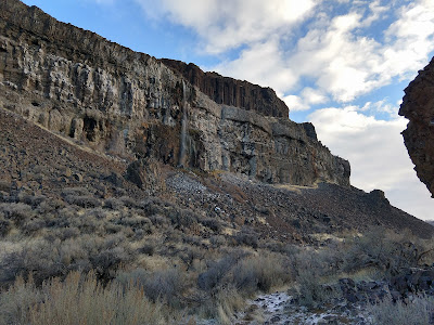
Rocks and water - Ancient Lakes

Long time no write! I've been busy working two jobs. I've been hiking, just not writing. So here we go for a late start to the hiking season!

Back in February I was single, so I took myself and the dog out for a Valentine's Day hike to coulee country. Winter is the time for desert hiking in my opinion. It's cool and there are no rattlesnakes out!

Ancient Lakes Loop
Washington State Dept. of Fish & Wildlife
Parking permit: Discover Pass ($10/day or $30/year)
Distance: 4.6 miles round-trip
Elevation gain: 278 feet
To get to the trailhead, take I-90 exit 149 if coming from Ellensberg or 151 if coming from Moses Lake, and head north on SR-281. After about 5 miles, turn left onto White Trail Road (Rd 5 NW). Wind through farmlands for 7.8 miles and take a left on Rd 9 NW. After a couple miles and a steep downhill grade, the pavement ends and the road becomes Ancient Lakes Road. Follow the road all the way to the end to the trailhead parking.

Even though there are lakes and waterfalls, most of the water is agricultural run-off from all that farmland you drove past earlier. You'll want to pack all the water you'll need for your hike. The valley is a popular backpacking spot; if you decide to camp overnight, make sure you bring plenty of H2O!

As you can see from the satellite, there are several trails that braid off the "official" trail. I ended up following the northernmost one and dead-ending at the lake, then working my way around until I joined the "official" trail. I don't recommend this. The path I took around the lake dwindled to nothing and ended up costing me a lot of energy to finish navigating. 

Otherwise, it was a beautiful hike. There had been a light dusting of snow the evening before. For most of the hike, the sun stayed behind a cloud and gave off some fantastic lighting.


At the easternmost lake, a waterfall in the distance can be seen. There's another trailhead above that waterfall somewhere, with a hike down the cliff. Someday I'll find that trailhead and hit the valley from that angle.


There's also supposedly a route that leads up the blade that separates this coulee from its next-door neighbor. I think I saw the route but couldn't get to it this time, so next time I'm gonna give it a shot.


In the summer, I imagine the heat is sweltering out here. For a February hike, it was nice and cool. I took off my jacket when I hit the sunny spots.


This is a great off-season hike (just check the road conditions, as there's a steep curve to contend with that I wouldn't want to attempt when icy). I'll definitely be returning to this area to access it from the other trailhead and check out Dusty Lake coulee to the south.

Thursday, January 18, 2018

A very muddy ridge and a new map

I've been doing more hiking up Ahtanum Ridge at Fullbright Park. I've found a larger network of trails and an improved ascent since my first time. Here, I made a map:

Ahtanum Ridge
Union Gap Parks & Rec
Parking permit: None needed (though register your car if you park inside the museum)
Distance: 2.5 miles round-trip
Elevation: ~800'
Head south on Main Street in Union Gap and head south toward Highway 97. Partway across the bridge is the turnoff for the park. You will also see signs for the Agricultural Museum. Drive all the way back and park either just outside the museum by the decommissioned military tank, or if it's a slow day park inside and register your vehicle.

The dotted blue trails include the original loop I discovered, as well as a few other paths. The purple trail is now my preferred route, and it adds 1.5 miles and 300' of elevation gain to my original loop. It's switchbacked out, so even though it's a higher point of elevation it's more of a manageable climb, as the other ascents are very steep and can hurt the toes. At the top, there's a dirt service road for the radio towers and a nice view of the lower valley; heading east to the end of the road offers a lookout of Rattlesnake Ridge as well.

The trailhead for this route is just inside the museum. Walk in and up toward the gate to the water tower. At the gate, you'll see the trailhead sign. There's a second trailhead at the military tank, and there are some connecting trails that cut over, so that's an option as well.

From the bottom, looking up

Climbing and looking out over Union Gap

Now I gotta say something: respect the mud. On my latest hike up here, the ascent was not bad. I left in the morning when the ground was still frozen, which gave me a nice solid surface to walk on. But by noon when I was descending, the sun had warmed the trail and all that frost had melted, turning the trail to mud.

Quickly, I learned that Eastern Washington mud is different than the Western Washington mud I am used to. In Western Washington, there are leaves and twigs and detritus mixed in with the mud that offer some level of traction, so while it makes a mess of things, it's generally still hikeable. Here, the mud is smooth, slick, and slippery. I fell on my face and on my ass multiple times. Near the bottom where the trail descents in and out of a gully, I literally slid down and was unable to climb out due to the slick mud and steep trail. This lead to bushwacking my way through the gully until I found a spot where I could safely climb out and rejoin the trail. It was not the most pleasant of hikes. I have learned my lesson the hard way.

When it's dry, though, it's a fantastic trail, so I will be returning many more times over the years.

View of the Lower Yakima Valley along the service road atop the ridge

Rattlesnake Ridge sits on the other side of the river

Clearing up some Rattlesnake Ridge misconceptions

I'd just like to clear up some misconceptions I've seen some hikers in online forums having about Rattlesnake Ridge.

There are two Rattlesnake Ridges in Washington State (at least, two that I am aware of). One of them has been in the media lately for having a crack and a slow-moving landslide that's led to recent evacuations and road closures. One of them is a very popular hiking spot in North Bend.

I would like to assure you these are not the same Rattlesnake Ridge.

The North Bend one looks like this:


The one with the crack is south of Yakima is adjacent to Ahtanum Ridge (see previous pics) and looks like this:


Rest assured, your favorite hiking spot is safe! I've seen so many people seeing the news headlines and panicking that Rattlesnake Ledge is in danger. It's not. You're good. Go enjoy your hike.

This trail up Ahtanum Ridge is safe too, as it's north of the fault (the slide is moving south) and is on the opposite end of the river.