Thursday, January 28, 2016

Up and Down - South Hill Stairclimbs

Not too far from my place are a few fairly decent stairclimbs that I'll share with you today.  It's a short walk that you can incorporate into a larger neighborhood walk if so desired.

Parking is on the street. On weekends, you can park at the nearby high school (just east off the map). There's also street parking near Taylor Ave & 24th, as well as along 22nd and 21st street. I came from the direction of the high school.

South Hill Stairclimb
Parking permit: none needed
Elevation gain: ~180 ft
Distance: 1 mile round-trip
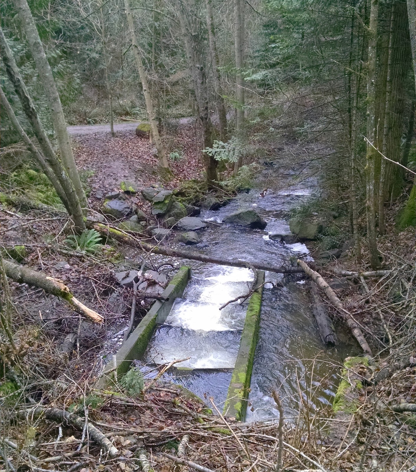
The main stair climbs are along Taylor Ave between Lenora Ct. and 19th St, but there's a nice drainage basin area between 22nd and 24th with some nature paths.


There's a bit of a loop through here, so you can take that if you like.


Heading up Taylor Ave from the trail, it's pretty much a straight shot uphill. You hit the first small stair climb just before 21st St.


Cross the street and go uphill, and you'll run into the big stairclimb. It has 104 steps, which is the third-longest stairclimb that I'm familiar with in town. (Woburn St stairclimb has 105, and WWU has a 106 stair climb near the Viking Union building...any other big ones in town?)


At the top of the stairs you can go right and that will take you into Lowell Park. I'm currently waiting for it to dry out a bit to map out the park. Google Maps doesn't accurately show the trail system and the city doesn't have any official park maps either. It's muddy when it gets wet, so when it's dry and my schedule lets me I'll be exploring that area.

For more stairs, you can go left. The road dead-ends, but there's a path that leads around a hedge and...voila!

Puppy photo-bomb at the bottom
I didn't know these stairs existed until recently (when I was trying to find a map for Lowell Park, actually), because from the top of the hill they aren't readily visible, and there are only a couple houses on that section of 19th St so you wouldn't just wander there to view them from the bottom.

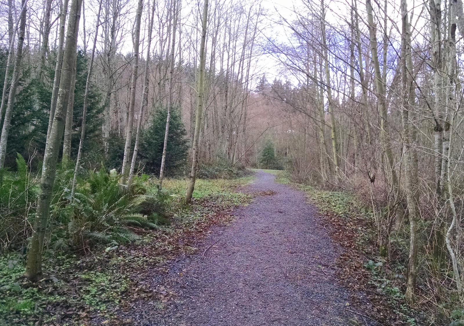
I found a sketchy-looking, muddy, not-very-legit path that led between lots and through a greenbelt to get back. I ended up at the bottom of the large stairclimb.


I came across three deer when I came out near the bottom of the stairs. Unfortunately my dog scared them away. In the middle of the pic below you can just see the butt-end of one of the deer darting around the bushes.


The dog, of course, was fairly pleased in himself for chasing off three large deer.

That's all I have for this week. It's been damp lately, and I've been busy with internships. I want to get Lowell Park soon though, and if I can't make it there I have ideas for more walks and, if the weather cooperates, some legit hikes as well. We'll see what I get to.

Thursday, January 21, 2016

Pup-friendly Shopping and Snacks - Rotary Trailhead to Fairhaven

I noticed recently that the Rotary Trailhead for the Interurban Trail has reopened. It was closed for a large portion of last year due to a big creek re-routing project. Now that it's reopened, I decided to go on one of my favorite walks with the dog.

The Interurban Trail stretches from Fairhaven all the way to Larrabee State Park, so the trail itself is quite long. From the Rotary Trailhead off Old Fairhaven Parkway though, it's only about a mile to Fairhaven. From there you can go west and take the Lower Padden Trails or north to a connector to South Bay Trail. Or you can just stop in Fairhaven and turn around to go home.

Parking is at the Rotary Trailhead, a well-marked parking lot on Old Fairhaven Parkway just west of 20th street.

Rotary Trailhead to Fairhaven
Parking permit: none needed
Distance: 2 miles
The recent work was very evident. The pedestrian bridge has been replaced; the original was about 15 feet or so further east.


The work involved widening the culvert under Old Fairhaven Parkway. It was barely evident the creek ran through here before, as a segment of it was underground in this area..


Now, it's much more obvious.


Across the bridge you'll come to Julia Ave. Hang right to head toward Fairhaven.


More views of the recent work.

Looking back at the trailhead

This section of trail was closed in addition to the trailhead itself.


Away from the new work, you can see the old culverts that route the creek under the trail. I'm unsure if there are plans to do anything with these.


A sign points you toward Fairhaven Park (south) and Padden Creek Trails.


The trail takes you under 12th Street Bridge before you reach the streets of Fairhaven.


More culverts
Eventually you reach 10th street. You can go downhill to the Lower Padden Trails or you can go straight along 10th Street to run into the connection to South Bay Trail.


This is a great area to take a dog. The Lower Padden Trails lead to an off-leash dog park. South Bay Trail has a Woods Coffee shop with a walk-up window so you can get your caffeine fix with your pooch.


In Fairhaven itself, there is the Whatcom Humane Society shop as well as Village Books, a pet-friendly bookstore.

At the end of this block, on the corner of Mill and 11th, is the bookstore.
There is also Fairhaven Fish and Chips at the corner of Harris and 10th. It's the double-decker red bus. Pet's aren't allowed in the inside seating areas, but most of the space is outdoors so you can walk up with your pooch and grab a bite to eat. They also serve ice cream. They are open weird hours, but you can swing by and see if you can get your hands on some fried food.


In fact, after a quick errand to the bank, that's where we went on this walk. Ozzy waited rather impatiently as the food was prepared.

I barely got him to sit still for a pic.

Heading back, I took a detour through Fairhaven Park. There is a playground and waterpark here, as well as picnic shelters and lots of field space. This also could serve as an alternate trailhead, though if the parking at the rotary trailhead is full it likely means parking here is full, too.


They also have a stone labyrinth.


"It's for people who like walking around in circles", another walker told her friend as they went by. Of course, she made the comment because her friend had wondered aloud why I was walking in circles.

Oh yes, I went off the trail and walked it. I will always walk it, to the annoyance of anyone I am with.

Detail of the center, with pup
So that's my favorite Fairhaven-area walk. From the rotary trailhead to the fish and chips and back was about two miles, but I often will walk it all the way to Boulevard Park.

Thursday, January 14, 2016

Starting internship

So I've been walking, but haven't actually been prepping anything for here. I've been using the Zombies, Run! app a lot, and fleeing from zombies doesn't combine well with photography. Also, I'm preparing for my internship which starts on Sunday! Super excited and nervous! I have to brush up on some basics and get my internship wardrobe in order, as well as turn in my application for graduation and deal with some other school stuffs. So exciting!

I did spend some time trying to chart a local park that has very few decent maps of it (that link is the best I've found so far). The city doesn't have any maps of its trail system. I tried to make a loop that I thought existed, but I couldn't find the right paths. I swear it used to exist though. Once I get a decent map of it, I hope to post it here.

I'll get some new content for next week, so stay tuned!

Thursday, January 7, 2016

Regrowth and Recovery - Whatcom Creek Trail

Today I took a short walk along a portion of Whatcom Creek Trail. I also downloaded the Zombies, Run! app, so I was getting chased by zombies the whole time! I walked, though at one point in the story I did break out into a jog because it was actually a fairly immersive app. I have the free version but I foresee myself shelling out payment for the full version soon!

Whatcom Creek Trail connects Whatcom Falls Park with downtown. From there, street routes take you to further trails that take you into Maritime Heritage Park; thus it is possible to follow the creek from where it begins at the lake to where it ends in the bay. I took one small portion of the trail today. I parked at the lower parking lot at Geri Fields near the corner of Puget St. and Fraser St. The trailhead was just down the road.

Whatcom Creek Trail
Bellingham Parks & Rec
Parking permit: none needed
Distance: 1.8
Elevation gain: not sure exactly, but there's a stairclimb with 105 stairs
There's a boardwalk-style walkway down Fraser with a crosswalk that leads to the trailhead.

Brought a walking buddy!

This shot was blurry because I was taking it while attempting to flee from zombies, but I think it sort of worked anyway.


The trail is never far from commerce. Cars and buildings abound nearby.


In 1999, there was an oil pipeline leak into the creek that lead to a large explosion. Three kids died. This totem pole along the trail near Racine Street came from Lummi carvers and serves as a memorial.


The explosion was set off within the park. If it had come down closer to these businesses, the damage and potential loss of life could have been much worse.


Valencia Street goes over the trail.


After Valencia, you'll run into road. Take left on Woburn and cross right at the light to rejoin the trail. From there, prepare to climb...


Our high school track team spent a lot of time running up and down those stairs!

From here you can start to see some of the charred tree remains from the explosion, though the area is actually healing quite well. There are also "peek-a-boo" views of town.


There's a small lookout where I turned around. Continuing along the trail takes you into Whatcom Falls Park and its associated trails for a longer walk.